- Since Myanmar’s 2021 coup, lead mining in the country’s southern Tanintharyi region has exploded, with the number of mining sites more than doubling as lawlessness enables rapid expansion.
- The environmental impact has been severe, with polluted rivers, dying crops, and communities losing access to clean water.
- Armed groups and junta officials profit from the boom by collecting bribes and taxes, turning mining into a revenue source across all control zones.
- Environmentalists warn that without immediate action and sustainable planning, the region’s ecosystems and natural resources may be permanently lost.
In July 2024, Maung Tu, 40, a manager at a mining company, purchased a betel nut farm of 2.4 hectares, or 6 acres, near the southern tip of Myanmar for nearly seven times the market price, paying approximately 200 million kyat (about $50,000 at the unofficial exchange rate).
He has little interest in the cash crop, despite the long-held cultural tradition of chewing betel nuts in the country. Instead, his focus is on extracting lead from the land.
“If the price of lead is good, the land price is good. They are directly proportional. If I am confident about the land’s potential, I will pay whatever price they ask,” Maung Tu said.
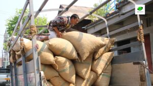
This is because while mining lead is more dangerous, the profit margin is staggeringly high compared to farming. Once mined, the raw materials are transported to Thailand, where the lead is cleaned and processed, and then on to China, which has long imported lead ore from Myanmar. Globally, the vast majority of lead consumption is for use in the production of lead-acid batteries, but local sellers said they don’t know who the eventual Chinese buyers are or what the lead is used for — but said armed groups in Myanmar and Thai traders are involved.
In the past, exporters had to contend with both community protests and a complex licensing process. Since the February 2021 coup, though, these obstacles have disappeared.
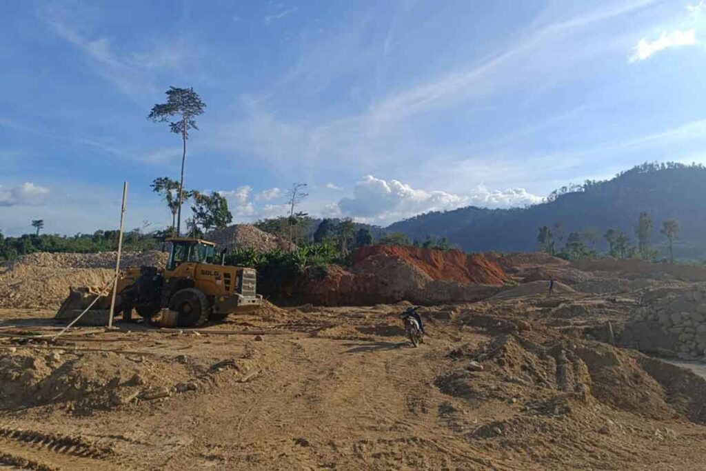
This has led to a mining boom in Tanintharyi, Myanmar’s southernmost region. Since the coup, orchards, farmland and rubber plantations have been transformed into mining operations, many of them illegal. Polluting and dangerous extractive activities that were once confined to riverbanks and streams have now expanded into gardens, residential areas, and even next to a police station.
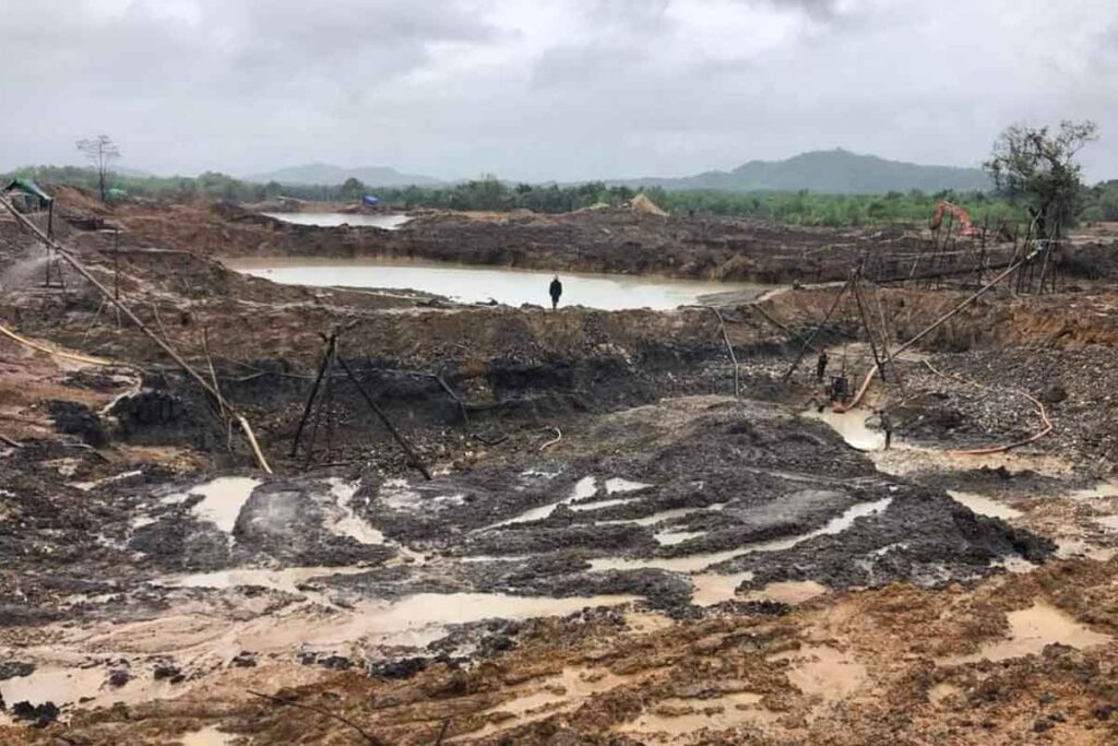
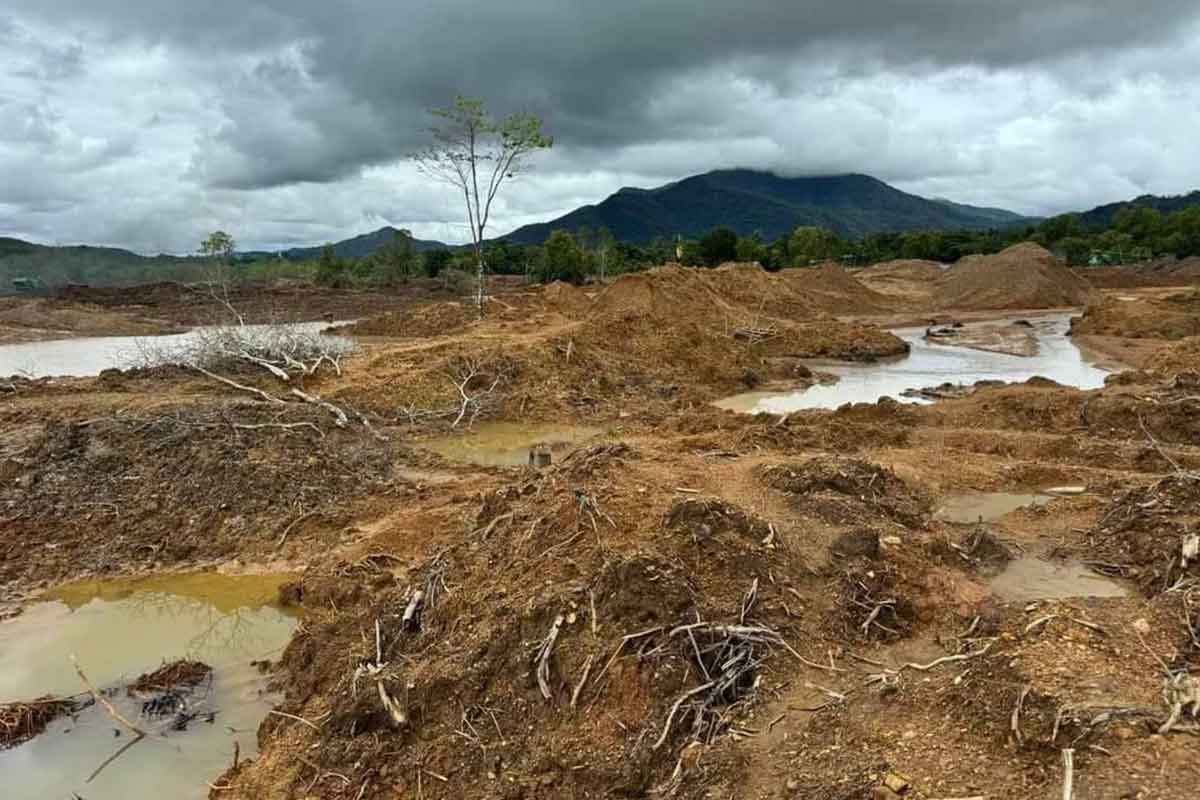
Our analysis of satellite imagery from Copernicus and Google Earth, verified by on-the-ground reporting and interviews with activists and community members, found that since 2021, the number of mining sites has doubled and the amount of land being mined has more than tripled. Taking advantage of general lawlessness and political instability across the country, the mines have devastated farmland, degraded soil, and killed aquatic life in rivers and streams.
Prior to the coup, the region held 30 mines covering approximately 3,108 hectares (7,680 acres). Satellite images from April 2024 showed there are at least 65 sites in the region, covering more than 10,120 hectares (25,000 acres), equivalent to about 14,200 soccer pitches. The distinctive markers of these sites — scoured yellow earth, tailings ponds, potholes — now riddle the province.
Lead, a toxic metal identified as “one of 10 chemicals of major public health concern” by the World Health Organization, is the main metal being mined, but some are also digging for gold.
Many of the sites we investigated are operated by opportunistic local businessmen or outsiders who reportedly pay the various armed groups present in the region — the military junta and its proxy militias, the pro-democracy forces, and ethnic armed organizations — to access these resources.
As in many parts of Myanmar where armed clashes have become near-daily occurrences, Tanintharyi now has three distinct zones: areas controlled by the military, areas controlled by pro-democracy forces, and contested areas where both are vying for control. Mining is booming across all three zones, and if left unchecked, could lead to total destruction of the environment and natural resources, environmentalists said.
Already, mine sites have become barren, streams and water sources have become polluted, and farms along waterways have lost their betel nut, rubber and durian trees after sediment from the mines caused the trees to wither and die. The accumulation of sediment has also caused streams and the Dawei River to become silted in some parts, making the riverbed shallower and obstructing the natural water flow. Environmentalists warn this can eventually lead to flooding.
“If the environment is destroyed it can’t be restored,” said Mae Su, head of the MAGGA Initiative, which monitors natural resource extraction in the Tanintharyi region.
A sign of lawlessness
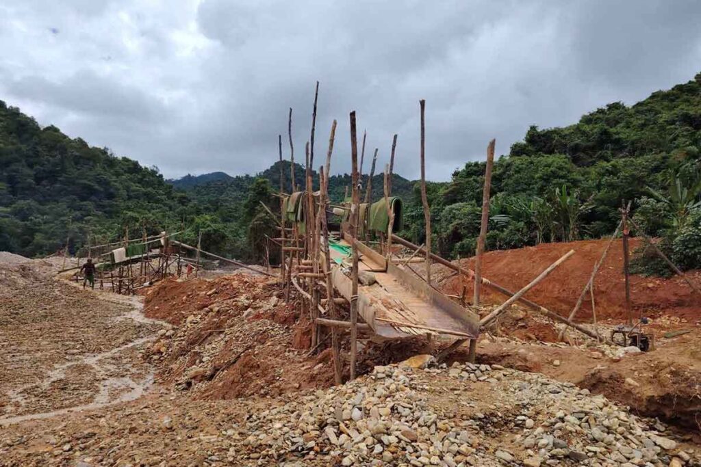
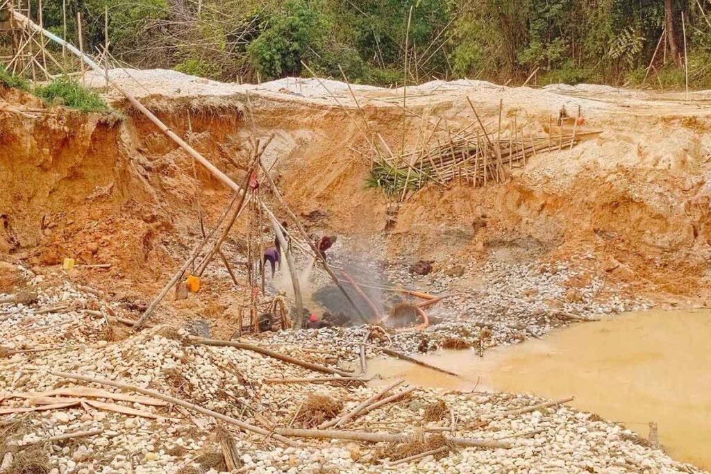
Small-scale miners have always been active in Tanintharyi, even before the most recent political takeover, extracting lead from rivers and the areas surrounding company mining sites. But the scale is now unprecedented.
Mining has become so pervasive in Tanintharyi that one site now hugs the back fence of the police station in the Kanbauk village tract in Ye Phyu township. That mine is operated by the Delco company, owned by Zahkung Ting Ying, also translated as Ding Ying, a leader of the New Democratic Army–Kachin, a border guard force under the military junta. The Kanbauk mine site is roughly 64 kilometers (40 miles) north of the regional capital, Dawei, and in an area that has been mined for metals since the time of the British colonial administration, more than a century ago. The area is also known for exporting natural gas to Thailand.
That a symbol of law enforcement now stands as an ironic witness to the growing lawlessness in the region shows how bad the situation is, said Aung Pan, a resident and former member of a community watchdog group under the previous civilian government.
“There is absolutely no rule of law at the moment. It’s not surprising that the very people meant to uphold the law are contributing to its decline. These are the times we live in,” said Aung Pan, who has been working on this issue for 12 years.
Data released by the central government’s Department of Mines in November 2021 showed that three companies held mining permits in this area: Delco with 845 hectares (2,087 acres); Poppa L with 15 hectares (37 acres), and Aung Hein Bo Win with 18 hectares (45 acres).
Up until January 2021, satellite images show that mining operations were limited to approximately 148 hectares (365 acres). However, images from April 2024 reveal a stark change: mining has expanded to nearly 405 hectares (1,000 acres), thanks to Delco expanding its operations and the arrival of new, individual entrepreneurs.
Delco did not respond to emails seeking comment.
Kanbauk is home to the Myanmar military’s Mawrawaddy naval base, which means most of the area is under the junta’s control. Here, businesses that want to dig for lead pay tens of millions of kyat in bribes to various branches of the junta, including the police and the administrators appointed by the military, according to both activists and businessmen.
“There’s no problem with mining as long as you have a good relationship with the military council-appointed administrators. You just need to be on good terms with them and pay them,” Aung Pan said.
Maung Tu, who said he hopes to reap the rewards from his small betel nut farm-turned-lead-mine, said he pays at least 3 million kyat (about $700 monthly) to Pyithusit, or the People’s Army, a proxy militia group for the junta, and local administrators.
“[Pyithusit] takes their share, the village authorities take theirs. They demand as much as they want, and we have no choice but to pay,” Maung Tu said.
Po In, a resident of Myeik, another major township in Tanintharyi, said the same thing is happening in his area, where the military has also retained control. Po In is also in charge of the Natural Resources and Environment Department of the 88 Generation Peace and Open Society, a pro-democracy group set up by former student leaders.
Areas under military control are currently limited to district towns with military bases and the strongholds of Pyithusit, where competition for mining operations is increasingly fierce, sources said.

Mining sites in the Tanintharyi Region as of December 2024. Image by Dawei Watch. (Click for full map.)
Power vacuum encourages mining boom
Satellite images and reports from the ground reveal that unregulated mining is also taking place in areas held by ethnic armed groups and pro-democracy forces, including the Karen National Union (KNU), the exiled National Unity Government (NUG), the People’s Defense Forces (PDF), and local PDF units.
There are at least 17 mining sites in the forested area of eastern Dawei alone, covering an estimated 1,780 hectares (4,400 acres) in an area that serves as a base for multiple armed groups.
In many of these areas, lead mining operations are mainly overseen by the KNU, Myanmar’s oldest ethnic armed group, and groups that emerged to fight the military regime, including the Kawthoolay Army (KTLA), local sources said.
They collect fees from mining businesses and manage the transportation of extracted lead, according to Peter, joint revenue officer for the Dawei Public Administration Council under the NUG.
“Nowadays, there is widespread cooperation between the mining companies and the armed groups,” Peter said.
In one instance, small-scale miners working under the KTLA in Hinda, where mining dates back to the British colonial era, even dug up the village road, claiming there were valuable minerals underneath, according to residents, who were unable to travel and transport goods as a result.
At a time when the NUG and the ethnic armies are fighting against a common enemy — the Myanmar junta — the NUG does not want to confront ethnic armed groups such as the KNU and KTLA for their roles in the mine sites, sources said.
“There are times when we have to be very careful when talking about [the mine issues] between us [and] armed groups,” Peter said.
The commander of KNU Brigade 4, which oversees this area, did not reply to a detailed list of questions.
To regulate the increase in mining activities, the NUG began collecting taxes on their operations in July 2024, with rates set based on the power of the mining equipment being used. The monthly rates, set by the NUG’s Ministry of Natural Resources, comes up to 100,000 kyat (about $23) for a single engine, with prices increasing proportionally for each additional engine.
Despite these taxes, environmental observers report that mining activities continue largely unabated.
However, the impacts of mining are even more severe in areas where there is a power vacuum. These areas frequently experience clashes between the resistance groups and the military. When the military advances, conflicts erupt, but after they retreat, revolutionary forces often take over.
Such areas are scattered throughout the Tanintharyi region, and attract both local entrepreneurs and outsiders, local sources said, making the region a Wild West.
The gold mining site at Zimbar Creek in Ye Phyu township serves as a stark example. Located within Tanintharyi Nature Reserve, Zimbar Creek, which originates near the Thai border and runs 26 km (16 mi), has suffered devastating destruction in a remarkably short time since the coup as a result of illegal gold mining operations.
The creek, which is an important source of water for both drinking and washing for some downstream communities, now looks like the surface of the moon. The water still flows but it is often very muddy and locals who continue to use it said they have developed skin rashes, and that fish catches have declined. Residents also express concerns about the health and environmental impacts of mercury, which is commonly used in small-scale gold mining.
The nature reserve area surrounding Zimbar Creek falls under the control of multiple factions, including the KNU, the military junta, and various revolutionary forces.
Urgent action plan needed
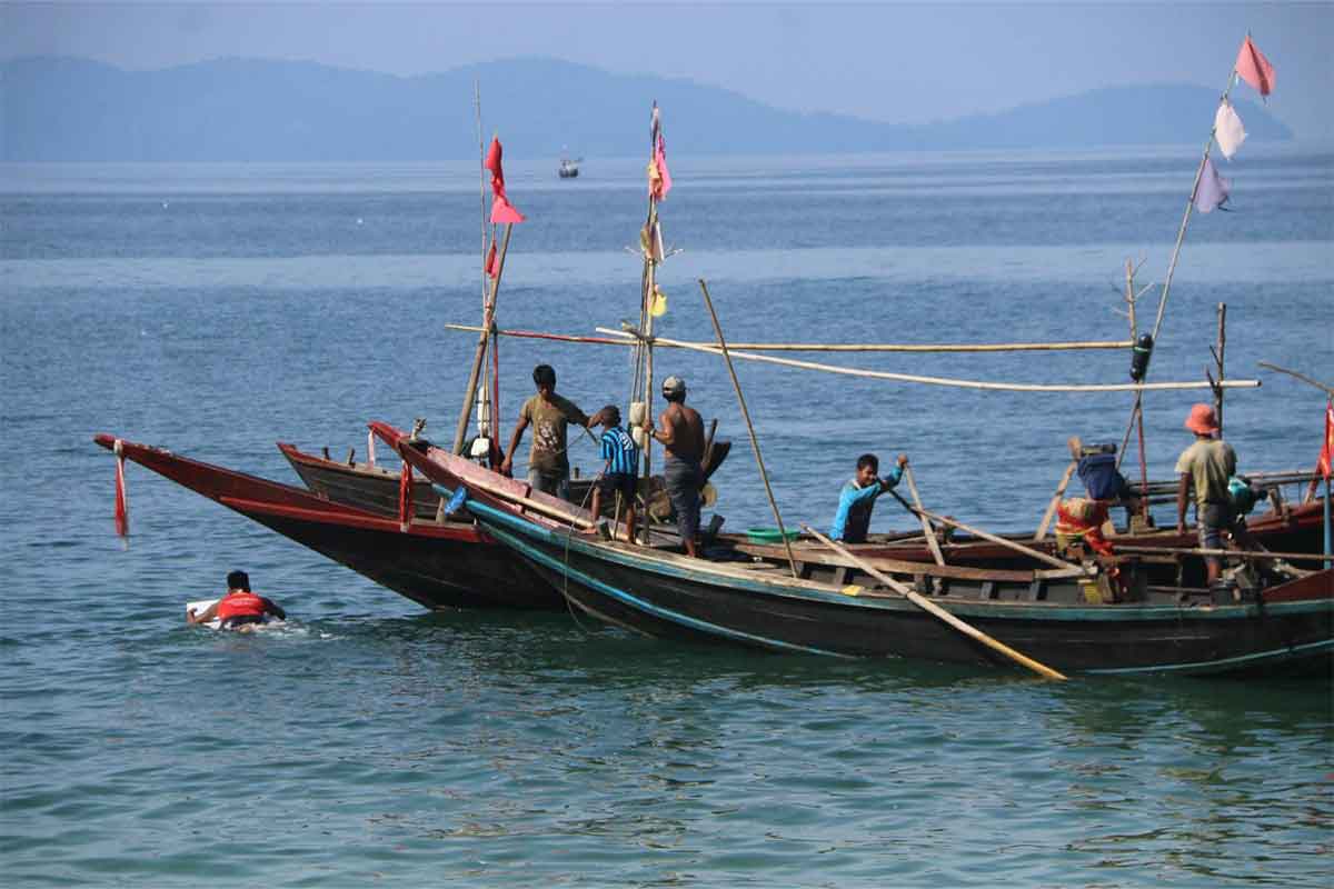
Nearly all of the lead ore mined in the Tanintharyi region is exported to Thailand, primarily through the porous land border, four sources told Dawei Watch. But lead is also transported via waterways to Ranong, a Thai province bordering the town of Kawthaung. Key export pathways include Htee Khee in Dawei district and border crossings in the Maw Taung area of Tanintharyi township.
The trade through land crossings involves armed groups working together with businesses, sources said.
“As far as I know, tons of it comes in from Kawthaung by cargo boats. When it reaches this side, someone with a Thai metal trading license buys it at the boatyard. Then they stamp it with the ‘Made in Thailand’ stamp,” said a trader in Ranong who did not want to be named.
The lead is then sent to Phuket, a tourist magnet better known for its sandy beaches and famous islands, where Chinese buyers then take possession of it, the trader added.
The mining boom has also led to land speculation, driving land prices to unprecedented heights. Some landowners have engaged in deceptive practices, such as burying lead on their land, to get higher prices.
Along with the environmental impacts, this means farmers are no longer able to cultivate crops along the rivers and waterways, locals have to find alternative sources of drinking water, and many of those who come into contact with the polluted waters have developed skin rashes.
A local aid worker helping displaced people in Tanintharyi township said, “Until around 2023, the locals along the Tanintharyi River used it for drinking water. By 2024 and 2025, nobody was doing that anymore.
“Previously, people relied on the Tanintharyi River for everything. Now, they only rely on water from wells and lakes,” he added.
Crops no longer grow on sand dunes on the river either, although locals are unclear why.
“Although skin rashes are seasonal and appear in the rainy season, many cases are occurring in the summer. I think it is not possible to say whether it is due to lead poisoning or not,” he said.
Yet some say such concerns take a back seat to the revolution against military dictatorship, a perspective environmentalists argue is short-sighted.
“If we continue to ignore environmental degradation, we will leave behind a legacy of destruction rather than one of value for future generations,” said Mae Su, head of the MAGGA Initiative, the monitoring group in the region.
Po In echoed this sentiment. He urged revolutionary forces to address environmental protection promptly and said they should educate local communities about sustainable resource management for long-term benefit.
Ignoring environmental issues during this critical period could result in irreversible harm, making it much harder to rebuild the region’s ecological and economic foundation in the future, he said.
A coordinated resource management plan between the NUG and the KNU is crucial to ensure sustainability, he added.
This interim management plan could be developed through dialogue with political leaders and decision-makers in the region to mitigate further harm, Mae Su said.
“If we don’t use these resources sustainably or take actions that benefit us in the long term, there will be nothing left for us to depend on once the liberation struggle succeeds,” Po In said.
The story was first published in English on Mongabay and in Burmese on Dawei Watch.
Banner image: Mining site in Ye Phyu Township, Tanintharyi, photographed around October 2024 by Aung Ban.
Dawei Watch is an independent news outlet established in 2012, with a special focus on covering southern Myanmar.
Editor’s note: Since the 2021 coup, it has been impossible to obtain updated information on mining licenses or other related data from Myanmar’s military government. Calculations of the size of mines relied on manual tracing of mined areas that were found using satellite images from Google Earth and Copernicus and were confirmed as mines by local informants. The calculations are therefore estimates, and do not include sites the team was unable to confirm.
FEEDBACK: Use this form to send a message to the author of this post. If you want to post a public comment, you can do that at the bottom of the page.
CREDITS

Isabel Esterman
EDITOR